Virgin and Moapa Peaks
Revised May 2010 - please send updates to the webmaster
Road Map for both peaks. See below for more detailed trailhead maps:
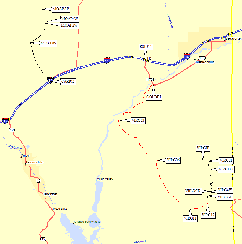
About an hour northeast from Las Vegas exit I-15 at large green Riverside/Bunkerville sign (waypoint RSID15). Go south, down and across the Virgin River. Turn right on Gold Butte Rd, the signed road junction immediately after the bridge (waypoint GOLDBJ), 3 miles from the freeway. This is a 25mph paved road past farms, going west and south along the Virgin River. About 11 miles from the freeway (waypoint VIRG03), the road turns southeast and climbs away from the river.
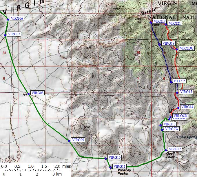
Approach to Virgin. Scroll down for more detailed trailhead map.
|
AT 24 miles from the freeway there is a 3-way split(waypoint VIRG11) just after the
pavement ends and the rock formations become interesting. Take the left-most dirt road,
past informal campsites often inhabited by motorhomes (cool rocks to hang out by or
climb on, but a bit dusty with traffic on the road). Cars and motorhomes have no
trouble getting here. 2.4 miles after that un-signed junction, 26.4 miles from the
freeway, turn left (north) on a small dirt track (waypoint VIRG12). There is a stake
saying Designated Route, but no road name on the stake. This track is OK for 2WD with
high clearance, but passenger cars should not attempt driving beyond VIRG12.
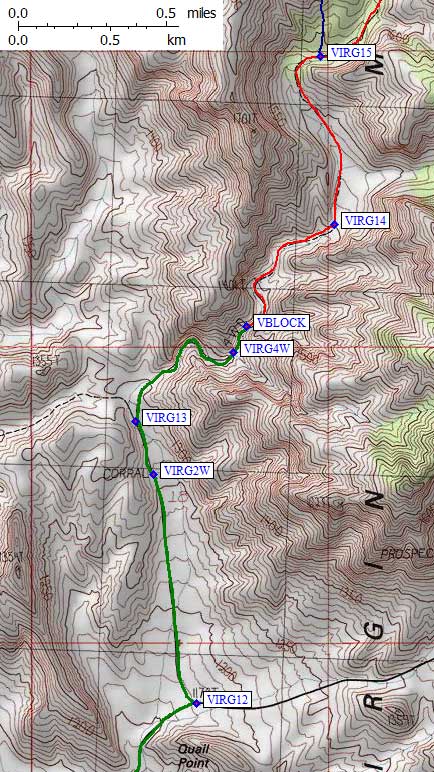
The track goes through a gate near an old corral which is the 2WD trailhead (waypoint VIRG2W) 0.8 miles from the (passenger car) dirt road or 27.2 miles from the freeway. Here there are old wrecked trucks, a cattle ramp, shotgun targets, and ranching litter. 4WD is advised beyond the corral, due to loose gravel. Take the right fork 0.2 miles from the corral (waypoint VIRG13), and drive up the wash to waypoint VIRG4W, the last good place to turn around or park. This is NOT the 4WD trailhead described in the DPS Guide (it's at 4400' instead of 5900'). Regular 4WD vehicles will be blocked at waypoint VBLOCK, 28 miles from the freeway, where iron pipes from a destroyed gate indicate the roadbed used to be several feet higher. Since the gravel roadbed in the wash has eroded, a large chunk of baserock (which some have called a boulder) now blocks the way for all but the best rock crawlers. There is no room to park here and it's hard to turn around. If you have an ATV or a dirt bike, just keep going through the slot - there were plenty of dirt bike tracks very far up this canyon in 2010. See also my 2010 trip report. |
|
|
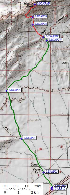
Less than an hour northeast from Las Vegas exit I-15 at the obvious Carp/Elgin Exit.
It's harder to find NEXT turn! Go north from the exit ramp a few feet until the paved
road forces you to turn right (northeast) at waypoint MOAP01. 100 yards from that
corner a dirt road goes northwest at waypoint MOAP02, with no marking except a
"Designated Route" sign. This is NOT a good road for passenger cars, because there
are center hump clearance problems and lose gravel patches. High clearance 2WD
will probably be OK if you know how to handle the gravel/sand.
The dirt road goes under high voltage power lines 1 mile from the freeway (waypoint MOAP03). A left fork appears to follow the power lines, but you want to go straight under them by crossing the powerline road. The corral mentioned in the DPS Guide is BEYOND the powerlines, and is just the remains of a wooden fence (not a good landmark). Ignore the fork 2.8 miles from the freeway (waypoint MOAP04). You might not even notice it because the left turn is blocked off with stumps and rocks. The road continues northwest until you are 5.2 miles from the freeway (waypoint MOAP05), where it turns northeast. From here to the trailhead there are several minor junctions where the left turn may say "route ends" and the main road stays right/straight. The main road (the one you want) slowly bends more to the north as it climbs an alluvial fan while staying parallel to an interesting ridge. 8.5 miles from the freeway there is a fork which ends up being a 100-yard loop around some old equipment. This is the 2WD trailhead (waypoint MOAP2W). It's another quarter of a mile and 100' of steep rutted road to the 4WD trailhead (waypoint MOAP4W). The 2WD trailhead has by far the best camping and it may not be worth spinning your wheels to drive that last quarter mile. See also my 2010 trip report. |
Useful Links: