Mt Tipton
Revised Jan 2009 - please send updates to the webmaster
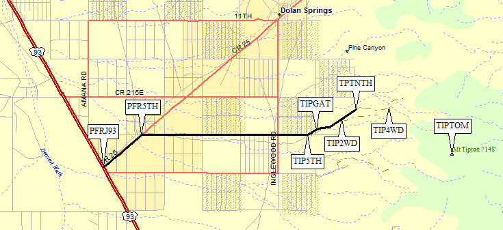
There is a small town on Hwy 93, called Dolan Springs, about 30 miles north of Kingman and about 40 miles south of Hoover Dam (near Boulder City). Leave Hwy 93 by turning northeast on Pierce Ferry Road (waypoint PFRJ93). This paved road is marked by a green street sign, and you'll see Dolan Springs signs also. In about one and a third miles, turn right on a tiny dirt road with a tiny green road sign saying 5th Street (waypoint PFR5TH). It's easy to miss this one. We thought it was a driveway at first.
Once on 5th street, which is narrow and sandy but passable for all vehicles, drive 4.3 miles due east to a completely unmarked and vague junction (waypoint TIP5TH) where you bear left (northeast). Soon you'll come to an unlocked gate with sign that says 'Please Close' (waypoint TIPGAT).
This gate, a cattle guard, and an abandoned water tank mark the wilderness boundary, and you may be entering private land also. The road beyond the cattle guard is still 2WD but clearance may be a problem for some vehicles. Less than a mile later there is an obvious parking area with a trailhead sign and register (waypoint TIP2WD). After that you definitely need high clearance but you'll never need 4WD.
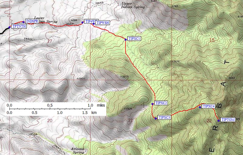
The road ends at a locked gate just below Indian Springs (waypoint TPTNTH). There is only room for 3-4 vehicles here. Walk up the road until it crosses the drainage at Indian Springs, jog right across wash, then find traces of road on the rib a quarter mile east of the crossing.
The old 4WD trailhead described in the DPS Guide (waypoint TIP4WD) is definitely not accessible by vehicle. You can walk up the road to that point, however, then go cross-country to the peak following the route below.
Useful Links: