Olancha Peak by Northeast Ridge
Revised 11 Jun 2012 - please send updates to the webmaster
GENERAL NOTES:
Here are the directions to get to the Olancha NE Ridge trailhead, as referenced from Jenkin's book:
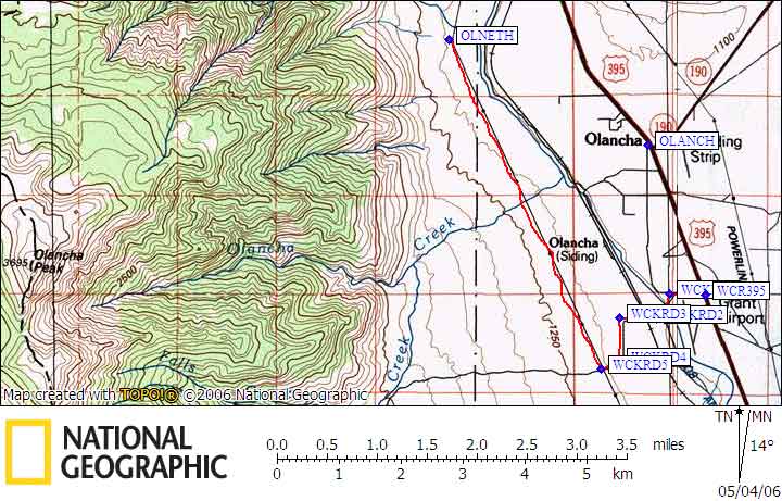
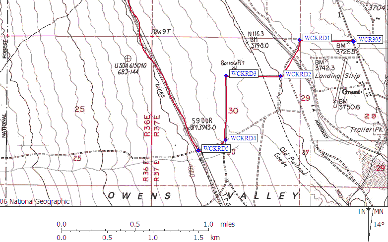
From the town of Grant just South of Olancha (if you reach Olancha, you're too far north), turn west off Highway 395 onto the unpaved, signed "Walker Creek Road" (waypoint WCR395, 0.0 mi). The first mile skirts jaggedly rectilinear property boundaries. You quickly branch Southwest (waypoint WCKRD1, 0.3 mi), cross the aqueduct on a narrow bridge and fork west (waypoint WCKRD2, 0.6 mi). Stay on Walker Creek Rd across a railroad track, pass a spur road, turn South (waypoint WCKRD3, 1.0 mi), later West at a junction (waypoint WCKRD4, 1.5 mi), then Northwest (waypoint WCKRD5, 1.7 mi) to follow the road right under, and parallel to, the powerlines (which might be Fall Road according to some maps, but there's no road sign at the intersection). Follow this road until the point where the lines and the road turn north-northeast in unison (waypoint OLNETH, 5.5 mi). Pull off the road and park (at about 3900 feet elevation).
The road is fine for sedans, although there is one spot along Fall Road where a creek cuts through the road. My old, cheap, plastic steed (a Mazda Protege) bottomed out both directions (going in and coming out), but it wasn't that bad.
Useful Links: