Convict Lake Trailhead
Revised Aug 2005 - please send updates to the webmaster
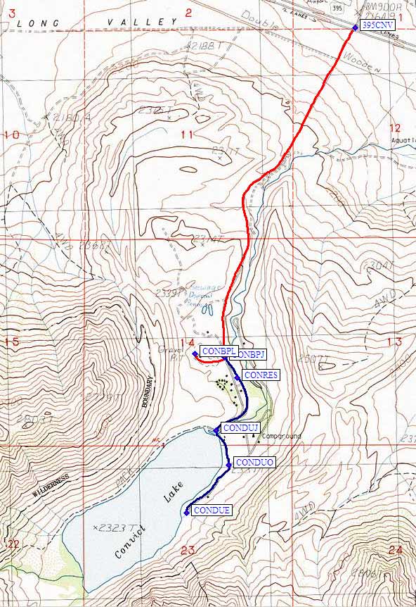
Leave Hwy 395 at Convict Lake Road (waypoint 395CNV) just north of Lake Crowley. The entire road is paved, and the entire area is heavily developed by Eastern Sierra Nevada standards.
If you're backpacking, follow the red line on the map below. Turn west toward overnight or backpacker parking at waypoint CONBPJ (downcanyon from the Convict Lake Resort). The backpacker parking lot is at waypoint CONBPL, about half a mile from the lake.
For day use, continue (the blue line on the map below) past the backpaker lot junction (waypoint CONBPJ), past the Convict Lake Resort (waypoint CONRES) which has a restaurant and lots of other development, past the sign that says 'No Parking 10pm to 4am', until you reach the lake at waypoint CONDUJ: Go right (west) for the boat ramp and the backpacker's trail, go left (south) for day use parking and Lakeshore Drive. There's a so-called 'Overflow Lot' at wayopint CONDUO, and there's also parking along the lake to the end of Lakeshore Drive (waypoint CONDUE).
Useful Links: