Twin Lakes Near Bridgeport
(Horse Creek and Robinson Creek)
Revised 11 Jun 2012 - please send updates to the webmaster
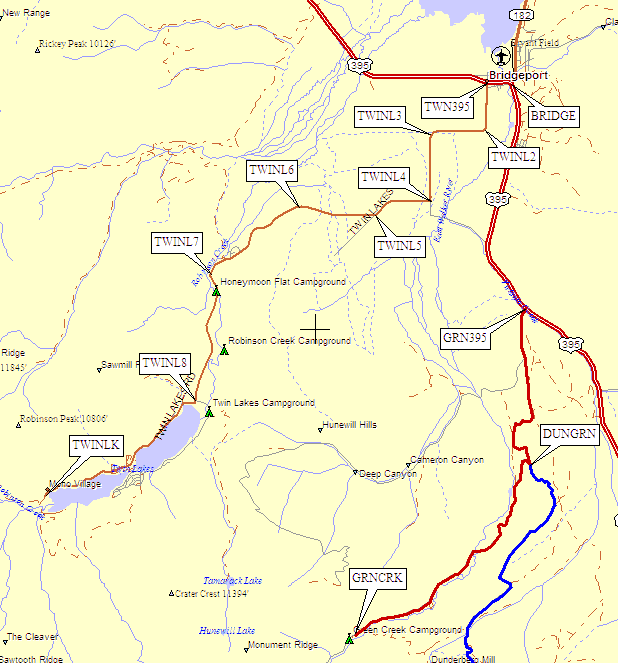
The Green Creek trailhead shows on this map, but is described on a separate page.
Leave Hwy 395 in Bridgeport at waypoint TWN395, about half a mile west of the intersection of Hwy 395 and Hwy 182 (waypoint BRIDGE). Follow the paved road to Mono Village, near waypoint TWINLK, where parking is free for dayhikers but you have to pay if you're staying overnight. Signs say your car will be towed away if you don't pay.
There are public hot showers at the Twin Lakes campground for a few bucks.
For the trailheads, go through the S.E. corner of the campground past a couple of campsites (RV sites) before heading across the streams on a couple of bridges. Anyone with specific trailhead details for either Horse Creek (to Matterhorn and Whorl) or Robinson Creek (for Petit, Piute, Volunteer) please contact me so I can upgrade this trailhead description!
Someone once said that if you get to the entrance to Mono Village after 4:30 a.m. you can park on the Twin Lakes road right outside the entrance for free... but it's unusual to have private land around a trailhead, so the normally lax Forest Service rules may not apply here.
Useful Links: