Desert Peaks - Region 9, Peak 3
Mexico
Generated on 5 Aug 2021 - see revision history - please send updates to the webmaster
| Picacho del Diablo in Mexico Region | |||||||||
| Num | Peak Name (more links) | Waypoint | Elev | DPS | Class | Pics and Reports | UTM hint (map) | 7.5' USGS topo quad | Register |
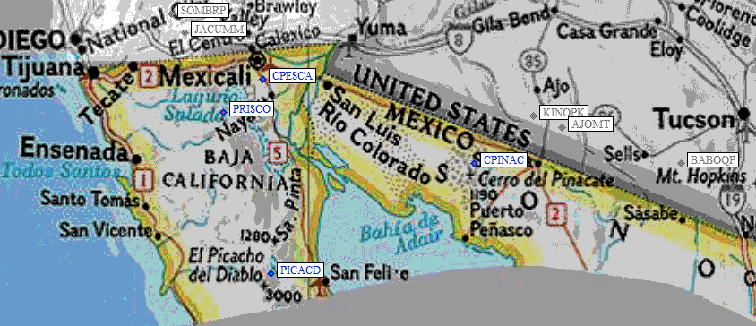
| 9.3 | Picacho del Diablo | PICACD | 10171+ | E | 3 | 6 reports on diablo | 552297 | Santa Cruz | |
| El Picacho del Diablo is usually called 'Big Picacho' by the DPS. It is also named Cerro de la Encantada. It is at 30°59.6’N, 115°22.5’W. It is NOT named on the topo. It is not the Picacho el Diablo that is 7.6 km to the NW near the observatory, nor is it the Pico del Diablo 4.5 km to the south. The code number of the map San Rafael is H11B45. The map to the NE is useful for driving; it is H11B46, Santa Clara. | |||||||||
NOTE: M = Mountaineers Peak, E = Emblem Peak, X = not on DPS List (in 'DPS' column)
      ^ = metric contours and elevations on 7.5' maps (in 7.5' map columns)
      Name Mt  => 'Mt' is before peak 'Name' (ex: Rose Mt is Mount Rose, but sorted on 'Rose')
      Name Mtn => 'Mtn' is after peak 'Name' as listed (ex: Muah Mtn is Muah Mountain)
The "UTM Hint" in the table above approximates the peak location to the nearest 100 meters.
Click here for info on Universal Transverse Mercator coordinates.
Useful Links: