Bear Box at Upper Paradise South (WC05)
Generated on 2 Aug 2022 - see revision history - please send updates to the webmaster
Detail Map of waypoint WC05
in Woods Creek Northern Rae Lakes Loop:
(scroll down for directions, waypoints, and area map)
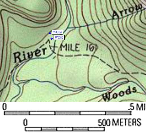
- WC05 is a large box, at about 6900 feet,
in the GPS route WOODS CREEK.
- Note: The 7.5' quad shows a sharp hook in the trail just west of where
it crosses the river, but that's now labelled as the Stock Crossing.
The foot trail continues through the campground and sort of vanishes
near a log jam which humans can clamber over without getting wet.
Both boxes are between the stock crossing and the log jam, WEST of
the South Fork of the Kings River.
- Directions from Peter Stephens (NPS), March 2006:
Use of these lockers is only available to through hikers on the PCT and
JMT. People who are starting or ending their trips in either Sequoia NP,
Kings Canyon NP,or Inyo NF and passing through this area are required to
carry portable food storage canisters and all food and scented items must
fit into the canisters. The public [should not] be misled into counting
on food storage locations that are not available to them. [Editor's Note:
Peter attached the document 'Special Public Use Limits and Closures for 2006'
which does not prohibit locker use by non-through-hikers, but does require
carrying a canister.]
- Directions from Steve Eckert, with GPS waypoint, July 2004:
One large box about 30 yards north of the campground sign
and about 10 yards to the downhill (east, toward the river)
side of the trail.
- Directions from Laura Civiello, Aug 2000:
One box between the trail and Woods Creek, north of the trail,
west of the South Fork crossing.
- WC05 coordinates: (see GPX waypoint download links above)
  (lat,lon) = (36.8696000, -118.5170300) in decimal degrees, NAD83.
  (zone,east,north) = (11S, 364866.0, 4081283.0) in decimal meters, NAD27.
- Scroll down for a regional map of the entire Woods Creek Northern Rae Lakes Loop region.
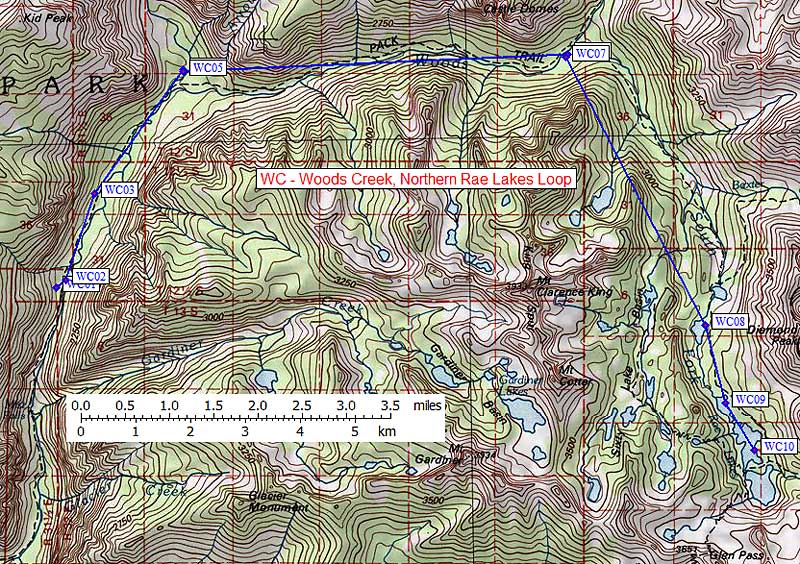
Map exported from TOPO! software, used with permission.
Useful Links: