Bear Box at Tyndall Frog Ponds (TC02)
Generated on 2 Aug 2022 - see revision history - please send updates to the webmaster
Detail Map of waypoint TC02
in Tyndall and Crabtree Area:
(scroll down for directions, waypoints, and area map)
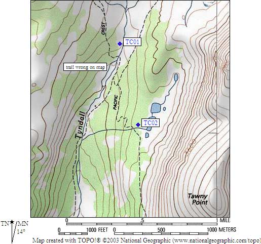
- TC02 is a standard box, at about 11000 feet,
in the GPS route TYNDALL CRABTREE.
- Directions from Bob Pickering, August 2019:
I couldn't find this bear box a few days ago.
My phone assured me that I was only 8 feet from the coordinates.
- Directions from Kit Groves, with GPS waypoint, July 2000:
One box about one half mile south of Tyndall Creek,
east of the trail and north of the Tyndall frog pond outlet.
- Directions from Mineral King ranger info sheet, dated 1991:
One box about one half mile south of Tyndall Creek,
on the east side of the trail.
- TC02 coordinates: (see GPX waypoint download links above)
  (lat,lon) = (36.6351700, -118.3853300) in decimal degrees, NAD83.
  (zone,east,north) = (11S, 376226.0, 4055101.0) in decimal meters, NAD27.
- Scroll down for a regional map of the entire Tyndall and Crabtree Area region.
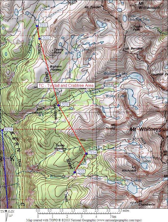
Map exported from TOPO! software, used with permission.
Useful Links: