Bear Box at Roaring River Ranger Station (RR02)
Generated on 2 Aug 2022 - see revision history - please send updates to the webmaster
Detail Map of waypoint RR02
in Roaring River:
(scroll down for directions, waypoints, and area map)
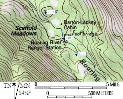
- RR02 is a standard box, at about 7400 feet,
in the GPS route ROARING RIVER.
- Directions from Steve Eckert, with GPS waypoint, Aug 2003:
One box on the west side of the Roaring River bridge and the south side of the
trail (behind a bearbox signpost) between the ranger station and the bridge
across Roaring River. There is a backpacker camping area across from the bear box
on the north side of the trail, and a hidden latrine west of (and uphill from)
the camping area. This is not a quiet place to camp, and horses may cover you
with dust if you camp close to the trail. A water spigot near the ranger station
is marked 'not potable'. There is a message board (with paper and pen) on the
ranger station door.
- RR02 coordinates: (see GPX waypoint download links above)
  (lat,lon) = (36.7126800, -118.5859800) in decimal degrees, NAD83.
  (zone,east,north) = (11S, 358426.0, 4063976.0) in decimal meters, NAD27.
- Scroll down for a regional map of the entire Roaring River region.
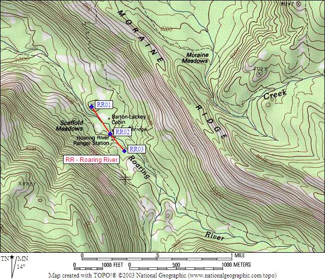
Map exported from TOPO! software, used with permission.
Useful Links: