Bear Box at Pear Lake East (LT04)
Generated on 2 Aug 2022 - see revision history - please send updates to the webmaster
Detail Map of waypoint LT04
in Lodgepole to Tableland:
(scroll down for directions, waypoints, and area map)
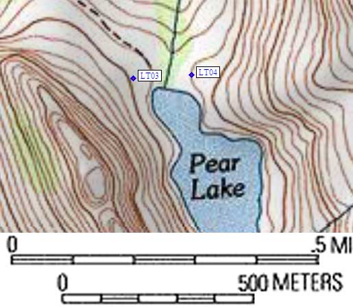
- LT04 is a standard box, at about 9500 feet,
in the GPS route LODGEPOLE TABLE.
- Directions from Steve Eckert, with GPS waypoint, July 2002:
As the trail from Lodgepole approaches Pear Lake, about 50 yards
before the trail crosses the outlet stream, you come to an
informational sign showing numbered campsites and bear box
locations. One box is on the other side (east) of the lake outlet,
about halfway from the 2-story rock-and-mortar solar toilet
and the lake. The box, and the campsites around it, are within
smelling distance of the toilet. Try to use the other Pear Lake box!
- Directions from Mineral King ranger info sheet, dated 1991:
Two boxes on the north side of Pear Lake.
- LT04 coordinates: (see GPX waypoint download links above)
  (lat,lon) = (36.6035600, -118.6679700) in decimal degrees, NAD83.
  (zone,east,north) = (11S, 350895.0, 4051995.0) in decimal meters, NAD27.
- Scroll down for a regional map of the entire Lodgepole to Tableland region.
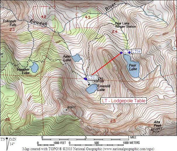
Map exported from TOPO! software, used with permission.
Useful Links: