Bear Box at Ninemile Creek (HS03)
Generated on 2 Aug 2022 - see revision history - please send updates to the webmaster
Detail Map of waypoint HS03
in High Sierra Trail:
(scroll down for directions, waypoints, and area map)
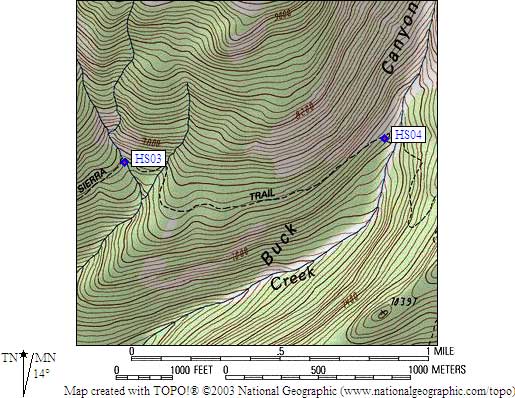
- HS03 is a standard box, at about 7500 feet,
in the GPS route HIGH SIERRA TR.
- Note: This Ninemile Creek (or 9 Mile Creek or Nine Mile Creek) is NOT
the one by Jordan Hot Springs! It is not labelled on the USGS maps.
Nine Mile Creek crosses the High Sierra Trail about 1 mile west
of Buck Creek and just over a mile north of Sugarbowl Dome (NOT
the stream that goes past Little Blue Dome). The name is apparently
based on distance from Crescent Meadow and Wolverton, each of which
are approximately 9 miles from the stream crossing by trail.
- Directions from Steve Eckert, with revised GPS waypoint, Oct 2002:
A use trail splits from the main trail just west of the western
fork of Nine Mile Creek, leading slightly downhill to great campsites
in the trees. There is a sign warning that a bear injured a hiker
here, and I saw a two of bear cubs (sans mama) in the area. The box
is visible 10 yards downslope from the main trail, and about 50 yards
on trail west of the creek (20 yards directly west of the water),
above the best campsites and over a rise from the creek.
- Directions from Paul Buehler, with GPS waypoint, April 2001:
One box just west of 'Nine-Mile Creek' on the south side of the trail.
There are actually two forks which confluence south of the trail.
The box is located just to the west of the WEST fork.
- Directions from Mark Connell, June 2000:
One box on the south side of the trail, west of the creek.
It is located about 50' from the trail (if I remember right),
at the west edge of the camping area. You won't miss the camp
sites hiking through there (I noticed them in the dark).
- Directions from Mineral King ranger info sheet, dated 1991:
One box by the trail on the west side of Ninemile Creek.
- HS03 coordinates: (see GPX waypoint download links above)
  (lat,lon) = (36.5711100, -118.6450000) in decimal degrees, NAD83.
  (zone,east,north) = (11S, 352888.0, 4048360.0) in decimal meters, NAD27.
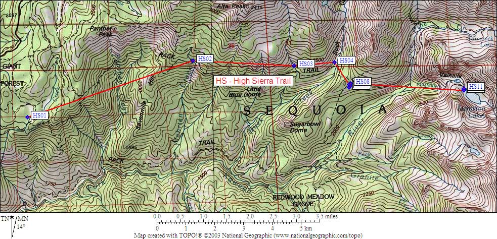
- Scroll down for a regional map of the entire High Sierra Trail region.
Map exported from TOPO! software, used with permission.
Useful Links: