Bear Box at Lower Lost Canyon (BA04)
Generated on 2 Aug 2022 - see revision history - please send updates to the webmaster
Detail Map of waypoint BA04
in Big Arroyo:
(scroll down for directions, waypoints, and area map)
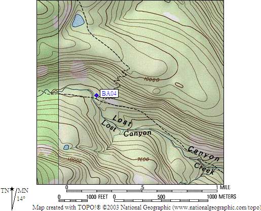
- BA04 is a standard box, at about 9600 feet,
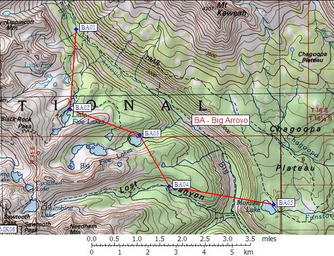
in the GPS route BIG ARROYO.
- Note: This box was apparently MOVED downcanyon from Columbine Lake to Lost Canyon in 2000!
- Directions from Arturo Crespo, with GPS waypoint, Oct 2001:
One box on the northeast side of the Lost Canyon Creek. East
side of the stream, North of the trail coming from Sawtooth
pass (via Columbine Lake), West of the trail coming south from
Big Five Lakes. The box is in plain view from the trail.
- Directions from Anne Hartman, Sep 2001:
The bear box at Columbine Lake has been removed in the last year or two.
We got one list of bear boxes from the ranger station at Sequoia that
listed the Columbine Lake box, so they're giving out some mis-information.
We ran into a trail crew in Little Lost Canyon and they're the ones who
told us that the box had been taken out a year or two ago, and, sure enough,
there wasn't one to be found.
- BA04 coordinates: (see GPX waypoint download links above)
  (lat,lon) = (36.4682100, -118.4963600) in decimal degrees, NAD83.
  (zone,east,north) = (11S, 366012.0, 4036728.0) in decimal meters, NAD27.
- Scroll down for a regional map of the entire Big Arroyo region.
Map exported from TOPO! software, used with permission.
Useful Links: