Sunday we just made the short but steep hike up to Upper Grass Lake (10400). We considered hiking another 300 feet up to Meysan Lake, but we liked the timberline feel and our sandy campsites, so we stayed. On Monday, Judy, Frank and I headed for Lone Pine Peak (12944). We expected it to be an easy warm-up peak, but it had its own challenges. We began our climb in a long sandy chute, gained the ridge, bypassed several false summits, and stood on the peak well to the east of the Pacific Crest. On this peak and on the others, Frank dispersed some of the mortal remains of his friend Bonnie Rama, and he signed her name into the summit register as the fifth member of our group. On our return, we entered the wrong chute and descended until we were at the top of a cliff band. We made a considerable search for the exit. At the end, we down climbed past a rappel station left by previous climbers who had made the same mistake, and then we traversed a nail-biter of a ledge before we finally got back onto the sand.
On Tuesday, Joe, Frank and I went out to climb Mt Irvine (13780) and Mt Mallory (13845) in a sweeping traverse. We enjoyed the long class 2 northeast ridge of Irvine. The ridge featured many gendarmes, but every problem could be worked to the left or right, or just over the top. We dropped down about 1000 feet from the summit Irvine of into the east bowl, then a mile across an unsteady talus field to the southwest slope of Mt Mallory. Once across, we walked easily up to the summit block. The final few moves to the highest rock were interesting and exciting. The descent to Meysan Lake goes through one of four chutes. Each gully is said to have downsloping granite ledges covered with gravel. We selected chute #2 based on a previous climber's report. The four choices were probably equally bad. We walked around the east side of the lake and arrived tired at our camp.
We admired the blank face of Mt LeConte, with its barely noticeable northeast ledge. We enjoyed reading Jim Ramaker's trip description, which resolved the pencil line ledge into a sidewalk from which the climber better not fall or else. Then we voted four to zero not to make a Wednesday sortie to Mt LeConte. The prospect of climbing back up and back down one of the four loose chutes contributed to our unwillingness.
I discovered a hole in my trip plan. Humping the packs over 13200 foot Al Green Pass to Iridescent Lake was a bad idea, because those same loose chutes were in the way of that route too. Instead, on Wednesday, we hiked down to the Meysan trailhead, drove to Lone Pine, changed our permit, and drove up to the Cottonwood trailhead (9600), and hiked to the vicinity of Cottonwood Lakes (10900). Thursday we made an easy trail hike over New Army Pass (12400) and down to Soldier Lake (10700).
On Friday, we day hiked down to Rock Creek and up the south slopes of Joe Devel Peak (13325). When we returned from the mountain, we still had energy for more. While we were on the peak, a large group of teenaged boys had crowded into our camp, so we took the opportunity to pack up and retrace our steps over New Army Pass. We spent the last night of our glorious Meysan Dixon trip at timberline, by Long Lake.
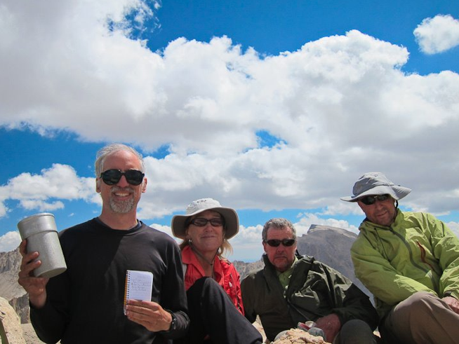
The photo, credit to Joe, is taken at the top of Joe Devel Peak.