| Aaron and I reached the Baxter Pass trailhead (waypoint BAXPTH) in a dusty wind storm... and decided to bail at least for the night. We reached the others by cell phone, discovering after we had left that Will had made camp at the trailhead before the wind kicked up and was going to stay in his tent. The rest of us spent night at the Independence Inn hoping for better weather in the morning. We were not disappointed!
A cold front had blown in but the 40-60mph gusts were fading the next morning. We regrouped at the trailhead and set off before 730am... apparently just in time because dust was once again rising in the valley.
A new sign at trailhead says there are no more bighorn sheep restrictions in this area - that's big news! All the maps and guidebooks that say you must keep out to avoid disturbing the sheep can now be ignored, according to this posting: | 
|
The first stream crossing is just over half a mile from the cars (waypoint BAXP01), where map shows it. The second stream crossing is downstream from where map shows it (at BAXP02) and the trail is vague or missing on both sides. Try to find a recently fallen log to cross, or pick a good spot to wade, and carefully note where you cross. It's easy to walk past best crossing on the way down. The trail then climbs on easy slopes and enters a steeper canyon around 8k (near BAXP05).
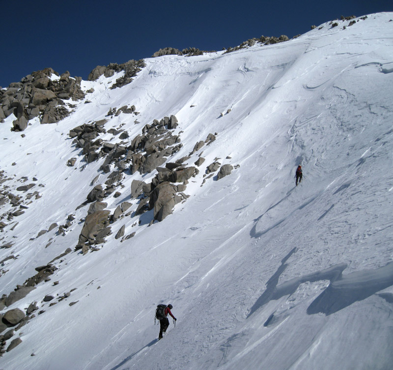
We saw the steep icy snow on the north facing side of the canyon, and talked ourselves into staying low and crossing to the north side of the stream where the snow had melted, but this was a mistake! Loose rocks and sand, or brush by the stream, made it tougher going than it looked. Shortly after crossing, Aaron took a small tumble and discovered his Koflach plastic boot had cracked from the gusset to the toe (perhaps the cause of the slip). Aaron hiked out alone and spent the weekend touring Death Valley. Now there were four.
We thrashed up the side of the stream until the terrain eased at about 8.2k, then got back on trail where it crossed the stream (waypoint BAXP06, which is again below where map shows the crossing). This area used to be a cool shady grove of pine trees, now it's a burned-out jumble of branches in the stream and rocks rolling down the slopes. The trail is often covered in debris. Standing dead trees will eventually give way to new growth, but it looks sad and barren now.
On the trail, we climbed up the north side of canyon on trail. This part is a pleasant walk from 8.3k to 8.8k where the canyon opens up and the snow became continuous. There was no sign of the trail above here. We donned skis and snowshoes as the snow softened in the afternoon sun. The cold front and a moderate wind made our hike up this canyon less sweaty than expected but even in late April we would have postholed without flotation footwear.
We basically followed the snow-covered stream, avoiding spots where the snow sounded thin, except we bypassed the area marked "Falls" on the map by staying to the north of the steeper snow (BAXP10). Above the falls we stayed above the willows and camping area mentioned in other reports (vertically above, as in 'unmarked snowpack'). Marching in the bottom of the drainage we saw and heard no more running water. The trail here sidehills up the north side of the canyon here but we were headed for the base of the moraine, not Baxter Pass.
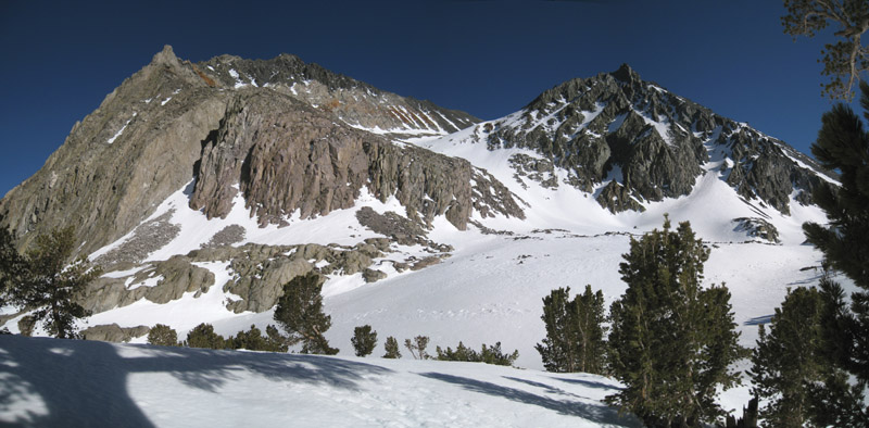
Mary Austin from camp
We found a good campsite at 10.8k, arriving just after 4p (waypoint HICAMP). 4800 feet of gain spread out over 9 hours of backpacking left us all feeling good (no altitude problems) and we had an hour or so of toasty afternoon sun before the canyon shadows overtook our side valley. While searching for the perfect spot to camp, Stephane noticed a low spot with darker snow. When probed with an ice axe, this turned out to be only a foot of snow over slow-moving water! No snow melting saved a lot of time and fuel, and surprisingly the water didn't freeze even overnight. The one person who broke through the snow discovered the water was shallow enough to not get in his boots. Running water and much less wind than in the main drainage made this a fine campsite.
It was 0 deg (F) overnight! Much colder than forecast, which had been dropping in the days before the trip. After a debate over dinner about when to get up, we waited until the sun hit the tents (leaving camp about 730am).
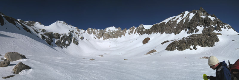
Will in the bowl between Black (left) and Diamond (right)
We followed the drainage into the bowl between Diamond and Black (waypoint BDBOWL), then angled up and west toward a break in the cliffs. The angle steepened at the base of a broad chute (waypoint DIMON1), and from 12k-12.5k there is a 35 deg slope. The chute tops out into an indistinct face (waypoint DIMON2), and you should take note of where to descend! (We went too far east when descending, and that chute ended badly in cliffs. Noticing this before it was too late, we had to traverse an easy 100 yards west to the correct chute on the way down.)
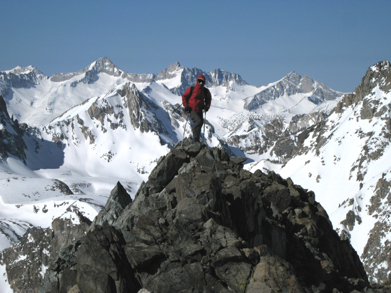
A broad summit plateau leads to the cliffy summit area and higher wind. The last bit of the summit ridge was nicely wind-carved, and it was 25 deg with a stiff breeze on top. We reached Diamond at 1045am where the register showed that no one had signed in since July 2010.
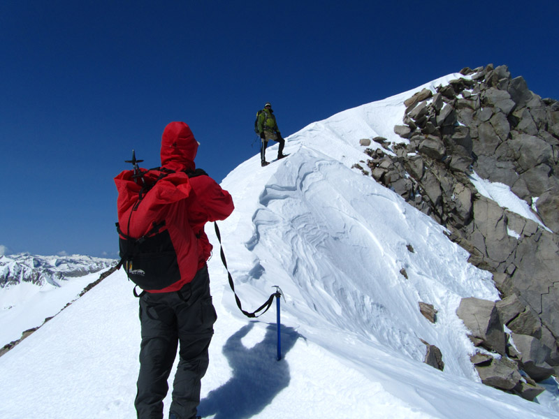
Stephane and Steve on Diamond's upper summit ridge - photo by Will Molland-Simms
Over 3 hours for 2400' of gain meant we were not moving that fast on the steep icy slopes, partly due to repeated stops to adjust gear. One person had forgotten crampons at home and another left his ice axe in the car. The good news for them was that Aaron's boot failure meant loaner equipment was available.
I glissaded as soon as the fall line was safe, Stephane skied from just below the first rock band, Will carried his snowboard down to the summit plateau, and Alex was glad to have crampons.
We regrouped at DIMON1, the 11.8k start of the traverse to Black Mtn, and had lunch around 1pm. It was still too steep and icy for Will to risk riding his board, the ice wasn't turning into corn, and he didn't want to carry his board around anymore, so Will skipped Black and headed home. Later we saw his board track from above camp down to the upper river crossing, meaning he had more fun that afternoon than on the climb of Diamond. Now there were three.
The traverse definitely demanded crampons, sidehilling on variable snow at an nominal 30 degree slope. One somewhat soft 40 deg slope next to a hogback (waypoint HOGBAK) was the "crux" of the traverse. From a distance this looked impossibly steep, but up close it wasn't too bad. The runout wasn't good and the snow alternated between breakable crust and icy windslab, but we continued southeast and were soon on easier slopes dropping into the bowl just north of Black. Don't climb too high, like we did, but stay on the 3700m contour (at 12.1k through waypoint BLKDIA) until you're in the bowl north of Black.
Alex and Stephane nearing the ridge on Black Mtn (note the windslab edges)
Around 12.7k (waypoint BLACK3) we turned southwest, climbing to the west ridge of Black instead of going straight to the peak. The snow was turning to packed powder with windslab layers that could break off in plates, and it was very steep directly below the summit. From the ridge it's an easy stroll to the top. OK, it was easier in leather than plastic boots, with a few handholds required over blocky terrain.
We got to Black at 330p, found the last sign-in was August 2010, noticed it was only 20 degrees and still windy on top, and headed down. Back to camp at 6pm, with the sun already gone, we now wished we had started earlier. Fortunately camp was set up and we had running water, so all the chores were done before it got dark.
Another cold night (5F this time) but this time we reconsidered the length of the day (climb, pack out, drive home) and left camp at 640am for Mary Austin. We climbed the gentle S-shaped chute in the shade, and it was windy so it felt much colder than the previous day. I lucked out because both sets of iron oxide hand warmers worked! I defrosted my leather boots while making breakfast both mornings, and felt some warmth from them almost until noon. Everyone else brought plastic boots, but the advance forecast had been for low 20's so I didn't bring boots warm enough for sub-zero temps. Oops. I hate counting on the backup plan but it's good to have one.
We walked into the sun when we hit the ridge just east of Mary Austin's west saddle (waypoint MARIDG). Hiding behind rocks we could avoid the wind and feel the warmth of the sun. The route follows right along the ridge to the summit. Sometimes there is a slight use trail and it's all easy class 2.
Stephane on a false summit of Mary Austin, with a good backdrop to the west.
We went between two false summits to reach the summit bump in the back, arriving at 9am. The ammo can register had no top and was setting upright, so the register book was frozen solid in a leaky ziploc bag. I guess some climbers don't accept the laws of physics. Upright cans with no lids collect water, right?
Stephane tore bits of metal edges off his skis chattering down the icy slope, I ripped my glissade sheet into shreds, and Alex walked down in crampons with no damage whatsoever. Toward the bottom there was a single 500' glissade down the chute and through the moraine to camp, but overall it was a nasty/hard/bumpy everywhere above camp!
The sliders got back to camp before 11am, we started packing out just after noon, and we were back to the car around 4pm. On the way down we stayed south of the stream on snow to BAXP06, ignoring the trail until we were below the snow line to avoid brush and make better time.
Map and waypoints:
- see the trailhead page
for driving directions
- click on the map for a full-size popup window, 1600 pixels wide!

![]() Download the Waypoint+ data below as a GPX file for your GPS.
Download the Waypoint+ data below as a GPX file for your GPS.
Datum,North America 1983,GRS 80,0,-1.6E-7,0,0,0
RouteName,1 ,BAXTER PASS TRAIL
RoutePoint,D,BAXPTH, 36.8446600000,-118.2975200000,05/06/2003,18:14:36,BAXTER PASS TRAILHEAD 6000
RoutePoint,D,BAXP01, 36.8435900211,-118.3073400259,04/07/1999,04:56:10,STREAM CROSSING
RoutePoint,D,BAXP02, 36.8432600498,-118.3122899532,04/07/1999,04:56:10,ACTUAL STREAM XING
RoutePoint,D,BAXP03, 36.8427400589,-118.3138999939,04/07/1999,04:56:10,VAGUE TRAIL
RoutePoint,D,BAXP04, 36.8417400122,-118.3237299919,04/07/1999,04:56:10,
RoutePoint,D,BAXP05, 36.8422000408,-118.3290300369,04/07/1999,04:56:10,
RoutePoint,D,BAXP06, 36.8393499851,-118.3344700336,04/07/1999,04:56:11,ACTUAL STREAM CROSSING IN GROVE
RoutePoint,D,BAXP07, 36.8400700092,-118.3346699476,04/07/1999,04:56:11,
RoutePoint,D,BAXP08, 36.8366899490,-118.3429000378,04/07/1999,04:56:11,
RoutePoint,D,BAXP09, 36.8351179361,-118.3536529541,04/07/1999,04:57:09,LOWER CAMP OPTION 9500
RoutePoint,D,BAXP10, 36.8352700472,-118.3564900160,04/07/1999,04:57:09,
RoutePoint,D,BAXP11, 36.8329937458,-118.3624572754,04/28/2011,15:36:16,
RoutePoint,D,BAXP12, 36.8295400143,-118.3694299459,04/28/2011,15:36:44,
RoutePoint,D,BAXP13, 36.8302199841,-118.3778799772,02/05/2003,07:48:16,
RoutePoint,D,BAXPAS, 36.8352532387,-118.3758885860,02/05/2003,07:39:42,BAXTER PASS
RouteName,2 ,DIAMOND PEAK
RoutePoint,D,BDBOWL, 36.8209400177,-118.3770600557,05/09/2011,00:27:51,BLACK DIAMOND BOWL 11300
RoutePoint,D,DIMON1, 36.8208625317,-118.3849792480,04/28/2011,15:47:24,
RoutePoint,D,DIMON2, 36.8237848282,-118.3849945068,04/07/1999,04:57:39,
RoutePoint,D,DIAMOP, 36.8263900280,-118.3900300264,09/02/2005,14:31:54,9_12 DIAMOND PEAK 13127
RouteName,3 ,DIAMOND TO BLACK
RoutePoint,D,DIMON1, 36.8208625317,-118.3849792480,04/28/2011,15:47:24,
RoutePoint,D,DIABLK, 36.8190100193,-118.3851000071,04/28/2011,15:46:49,NORTH END OF TRAVERSE
RoutePoint,D,HOGBAK, 36.8168900013,-118.3839700222,01/06/2007,17:33:04,STEEPEST PART OF TRAVERSE
RoutePoint,D,BLKDIA, 36.8159142733,-118.3818817139,05/09/2011,01:03:39,SOUTH END OF TRAVERSE
RoutePoint,D,BLACK2, 36.8143057823,-118.3797760010,04/28/2011,15:45:51,
RouteName,4 ,BLACK MTN
RoutePoint,D,BDBOWL, 36.8209400177,-118.3770600557,05/09/2011,00:27:51,BLACK DIAMOND BOWL 11300
RoutePoint,D,BLACK1, 36.8187874556,-118.3778686523,04/07/1999,04:57:38,
RoutePoint,D,BLACK2, 36.8143057823,-118.3797760010,04/28/2011,15:45:51,
RoutePoint,D,BLACK3, 36.8107399940,-118.3795700073,01/06/2007,17:33:04,
RoutePoint,D,BLACK4, 36.8098100424,-118.3803600073,05/09/2011,00:48:08,WEST RIDGE BLACK MTN 13000
RoutePoint,D,BLACKM, 36.8091200590,-118.3780499697,09/02/2005,14:31:54,9_11 BLACK MTN 13291
RouteName,5 ,MT MARY AUSTIN
RoutePoint,D,HICAMP, 36.8274699450,-118.3717299700,04/07/1999,04:57:11,RUNNING WATER UNDER SNOW 10800
RoutePoint,D,MACHUT, 36.8222547770,-118.3670876026,04/28/2011,15:43:32,NW CHUTE TO MARY AUSTIN
RoutePoint,D,MARIDG, 36.8149000406,-118.3671699762,04/28/2011,15:42:34,MARY AUSTIN W RIDGE 12600
RoutePoint,D,MARYAM, 36.8152199984,-118.3628699780,09/02/2005,14:31:54,9X14 MARY AUSTIN MT 13048