See the trailhead link above for lots of details on how to get to the 4WD trailhead and waypoints for the drive and climb. If you can't get there, it's short enough you can walk from the passenger-car-compatible Camp Rock Road.
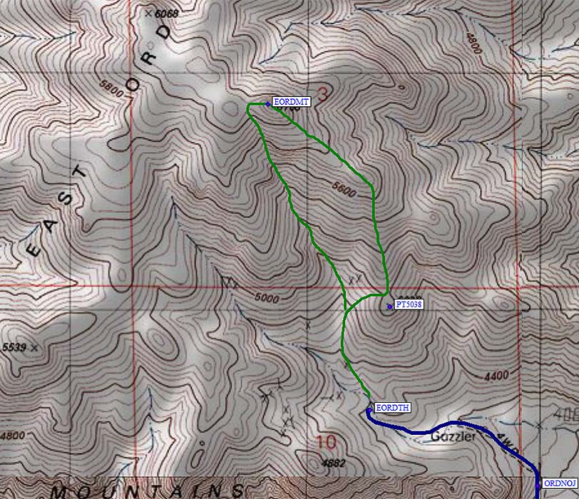
We walked the green line on this map. Up the ridgeline (the east part of the green loop) and down the gully. They're both pretty easy, but the ridge is more scenic and I liked it better. Make sure you don't start up the road from the parking area because that will take you to the wrong drainage.