After work on Friday, July 26 I flew up from San Jose to SeaTac Airport, rented a car and drove the two-hour stretch to Mt. Rainier National Park. I made it to the inn at Paradise at 5400 feet. I managed to get one of the two remaining rooms at the inn (very expensive and not worth it, but convenient since there were no legal campgrounds in the vicinity).
On Saturday morning I had breakfast at the inn and toured the nearby visitor center. I got a permit to climb the peak and camp at Muir Camp (The ranger told me that I was the last one allowed at Muir Camp that evening). I signed up as the leader of a group of 2, since solo climbers are not allowed without written permission from the superintendent. This meant that I had to pay double the climbing fee of $15.
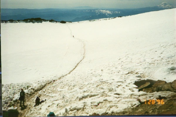
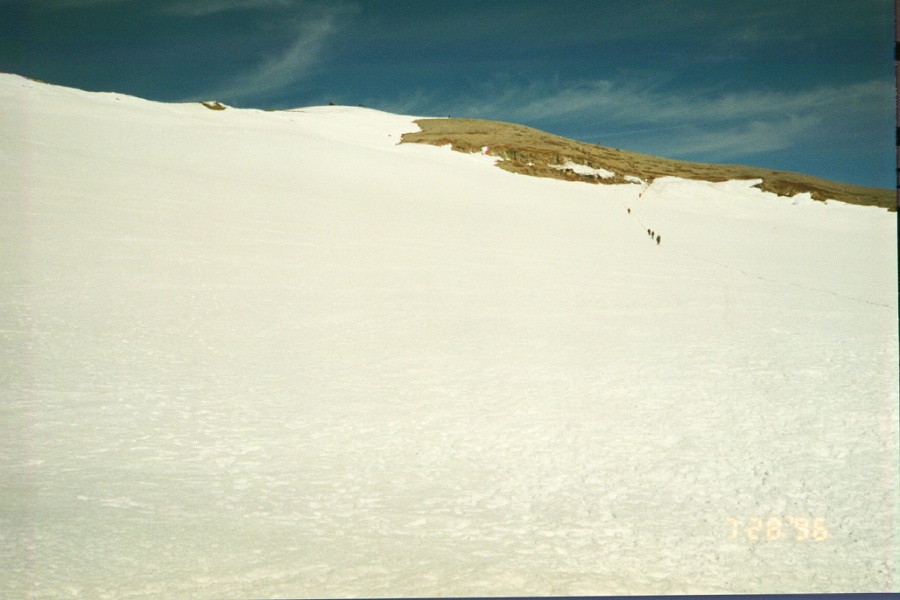
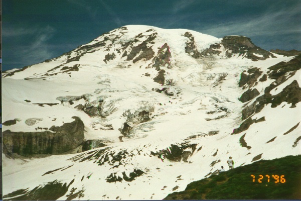
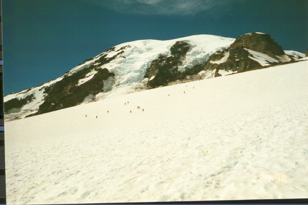
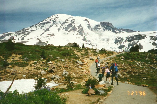
I put on my pack around 1 p.m. and started up the trail to Muir Camp at about 10,000 feet. The weather was perfect and the scenery was grand: beautiful meadows full of wildflowers and beautiful mountains including Mt. Adams, Mt. Hood and Mt. St. Helens in the distance. The hike was a little over four miles long and I barely made a mile an hour. There were hundreds of people on the trails and dozens up on the Muir snow field.
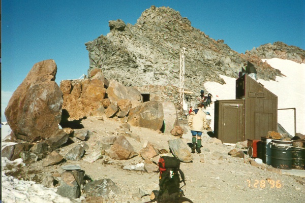
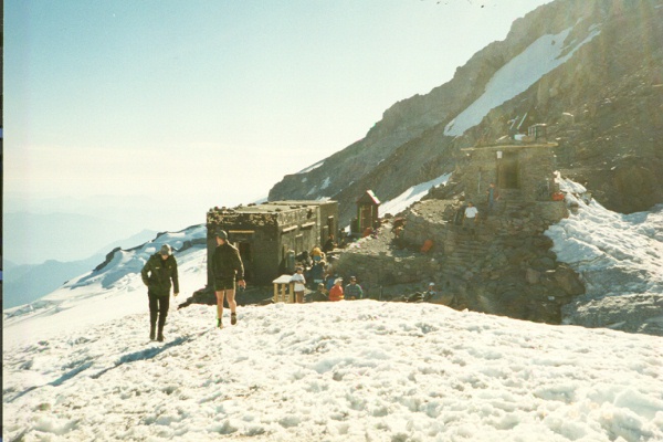
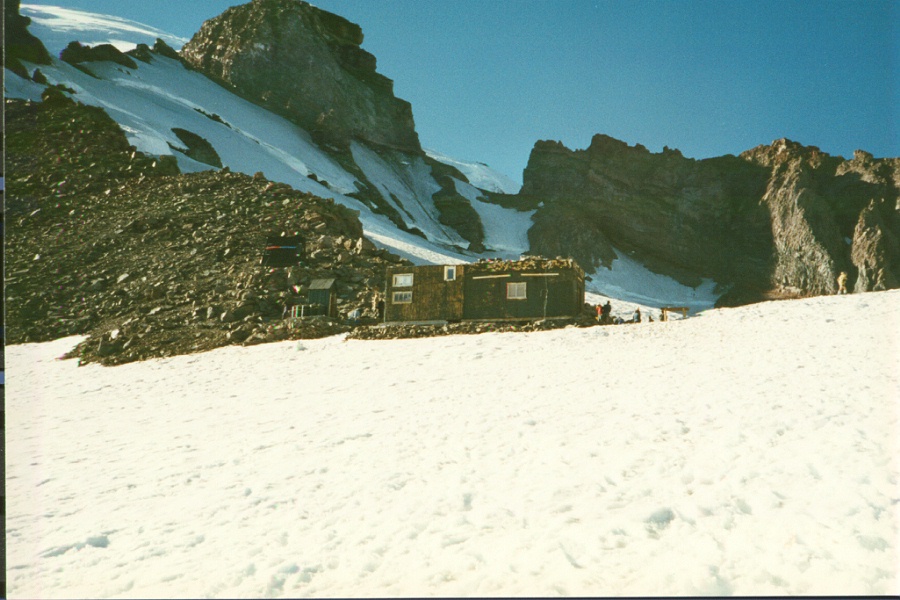
The camp is just beyond a saddle at the top of the Muir Snow Field. It was very crowded by late afternoon when I arrived. There were a couple of huts used by RMI (the guide service) guides and their clients and another open to the public. I simply bivied on one of the few snow-free sections next to a helipad. A ranger came by to check my permit and asked me who I was roping with. When I informed her that I was going solo, she said this was not allowed and that I must ask around for a hook up. Fortunately, I found some nice people from Oregon who had three on a rope and were willing to let me be fourth. The ranger said that the mountain was patrolled and solo climbers without a solo permit would be fined. I explained that I had climbed Mt. Blanc, a more heavily glaciated peak, without a rope. She insisted that Rainier has larger crevasses and is more dangerous (this is nonsense, but I agree that even though I felt comfortable going alone, it is safer to rope up).
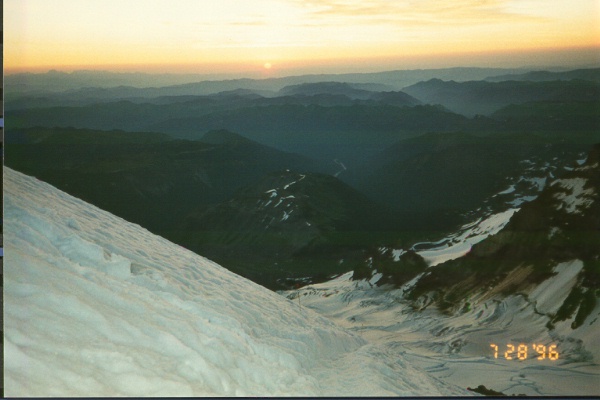
At 11:30 p.m. Saturday night, the RMI people (22) started getting ready and they were off about midnight. My party got up later and we departed at 1:15 a.m. I was last on the rope which was led by a 61-year old man and his wife. A younger woman (Amy) was third and I trailed. They moved slowly up the mountain. We immediately encountered several crevasses. We skirted past some and walked or jumped over others. It was quite a sight to behold all the head lamps going up the mountain and reminded me of the early-morning scene on Mt. Blanc. It was not necessary for me to use my lamp due to the bright moonlight and the light shining from the lights of the other climbers. I was told that not including the people using the guide service, there were 169 climbers on the mountain that day!
About 20 minutes after our start we stepped onto the Cathedral Gap, one of the few rocky spots we were to cross on this snowy mountain. We got back onto the snow another 20 minutes later, crossed the biggest crevasse on the route and then got onto the steepest ground we were to encounter. There were two sections of fixed rope that we clipped into for added protection. Then we were on "Disappointment Cleaver" (which incidentally is the name for this, the most popular route). I gather that the "cleaver" is a ridge that separates the Ingraham and Emmons Glaciers. Perhaps it is called "disappointment" because this is where sick climbers turned back. Amy almost turned back due to altitude sickness, but she was persuaded to push on.
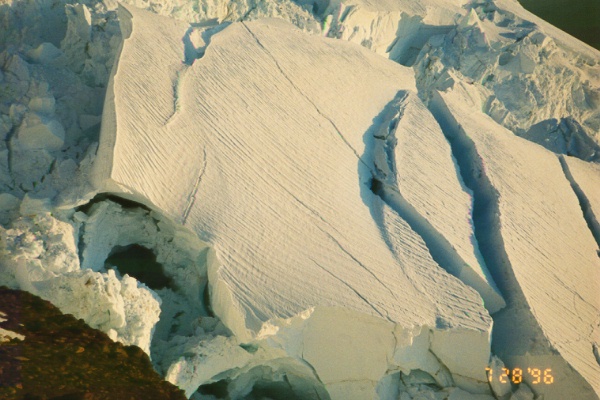
After the cleaver, we crossed a spectacular section of seracs, crevasses and broken ice as the sun came up. My guide book shows a fairly direct route above the cleaver to the rim. However, due to the ice falls and crevasses we followed a much longer approach, zig-zagging up the slope to avoid the major obstacles. I estimate that we covered about 4 miles from camp to summit.
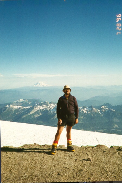
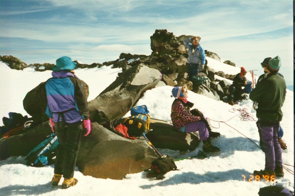
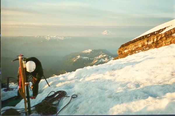
We arrived at the rim a little after 9 a.m. The glorious weather continued and we enjoyed the panoramic views from Oregon to Canada. We crossed the crater, which is flat as a table, in order to reach the summit register and climb "Columbia Crest" which is the highest bump on the rim.
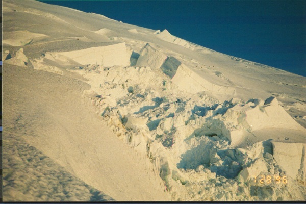
Shortly before 11:30 a.m., I roped up with another team (led by the son of the man who led me up) since they were faster. I wouldn't have been in a hurry, but I had to catch my flight back to the Bay Area that evening. We moved quickly and were able to glissade several hundred feet. The light of day revealed the impressive crevasses, seracs and ice falls that we had passed in the night. I stopped to take numerous photographs. We were back at Muir Camp at 2:30 p.m. I exchanged addresses with my benefactors, promised to send them copies of my prints and immediately dashed off Muir Camp. I glissaded and ran down the Muir Snow field, but slowed down on the rocky trail when my feet started to ache. As I descended in the late afternoon, it rained briefly and clouds obscured the top of the mountain. At 6 p.m. I was back at my car.
Needless to say, I was proud of my success and happy that I was able to summit on a two-day weekend, without burning any vacation time. I found the peak somewhat easier than I expected, given its reputation. The maximum inclination was only about 35 degrees and the overall difficulty was about equal to the Avalanche Gulch route on Shasta. Of course, I climbed the easiest route under ideal conditions. Incidentally, I was surprised to read that Shasta is actually more massive than Rainier. From a distance, Rainier looks bigger than Shasta and I couldn't accept the fact that Shasta is more massive until I was quite close to Rainier. Rainier is much icier, however, and [at 14,411 feet] it is about 200 feet taller.