Rodecker Flat and Sand Canyon
Revised 11 Jun 2012 - please send updates to the webmaster
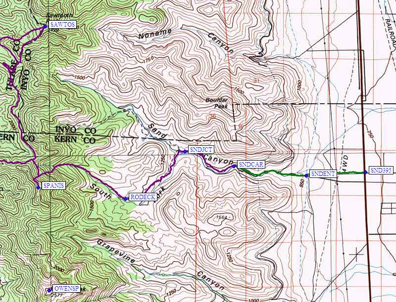
Rodecker Flat is an interesting trailhead for ascents of Spanish Needle, and could provide access to Sawtooth (S) and Lamont also. Most climbers go in from the west, from Canebrake Road, but this is an alternative.
Take Sand Canyon Road west from US-395 (waypoint SND395), north of the junction of highway 14, and south of the junction of Nine Mile Canyon Road (see waypoints 3959MI and 395014 on the Hwy 395 Waypoints page).
The turnoff is immediately opposite Brown Road, which is insignificant but marked with a road sign (Sand Canyon Road is not signed). Pass under the L.A. aquaduct near waypoint SNDENT. (Consider camping in the trees near the aquaduct instead of at the desolate location at the end of the road.) Continue to the gated road's end at 3200 feet (waypoint SNDCAR).
Follow the old road on foot to Rodecker Flat at 4300 feet (waypoint RODECK) and then continue up the drainage on reasonable cross-country footing to the base of Spanish Needle.
Useful Links: