Cerro Pinacate (Mexico)
Revised 12 Dec 2012 - please send updates to the webmaster
| Matt Hengst adds in 2012: We arrived before 8am and had to wait until someone showed up. The guy was friendly and spoke fairly good English. At first we were told they had closed the volcano for restoration projects a few weeks before and we'd need approval of the head guy to go back there. He seemed sympathetic to how far we'd come and promised to plead our case if we waited. He then talked to his chief and the story changed. While there were restoration projects, that wouldn't stop them from letting us up there. Instead there was some sort of security issue in the specific area of the volcano that he wasn't allowed to talk about. He recommended calling before coming down there to see if the situation was safe enough to allow access to Pinacate. I couldn't get specifics from the guy but it seemed to be something particular to the time period and location. We could enter the reserve itself and other areas away from the roads were supposedly safe. At one point he said coming back in February or so would likely be a better bet and gave me contact information to check with him next time. |
|
If you're coming from Phoenix, take I-10 west and Hwy 85 south through
Gila Bend (at the intersection of Hwy 85 and I-8). Continuing south on
Hwy 85, go through the town of Ajo to the junction with Hwy 86
in the town of Why (waypoint WHYJCT). This is significant
because you might be bored with the drive and need to ask why about
something to pass the time. It is also significant because you would
take Hwy 86 east from Why to Baboquivari
if you're doing it also. Since you're driving through Ajo, you might
as well stop for Ajo and Kino.
Follow Hwy 85 all the way to the US-Mexico border in Lukeville (waypoint LUKVIL). The border crossing is open from 6am to midnight, and didn't seem busy or formal to us. It might get crowded on holidays and weekends as people from Phoenix make their way to the closest beach. As of June 2009 passports are required. There is a filling station/grocery/cafe/etc on US side. You can pay the filling station $10 for day parking right across the street from the border guards. Now that's a safe carpool lot!! Others have left spare vehicles at the Organ Pipe Visitor Center near Mt Ajo. | 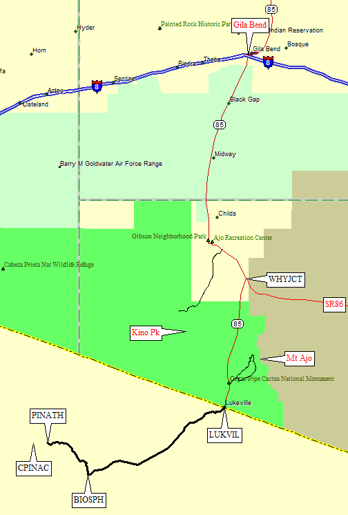
|
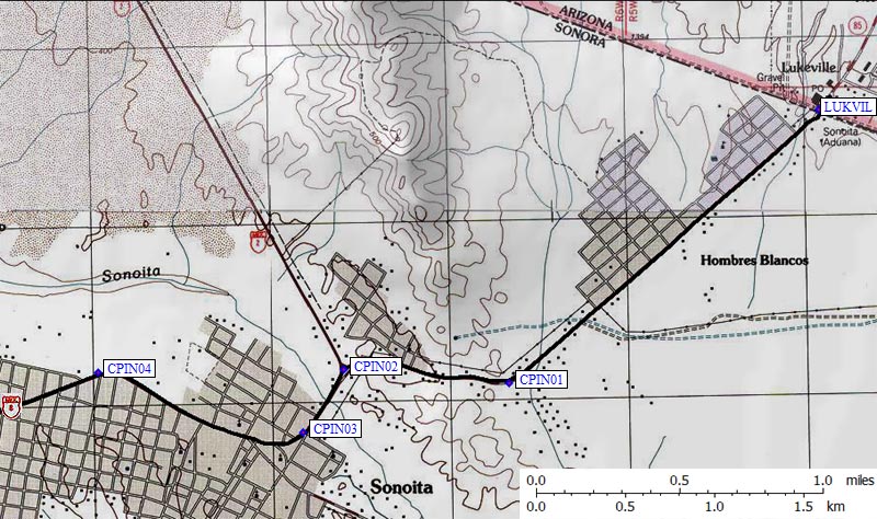
Once in Mexico, follow signs for Hwy 2 into the town of Sonoyta (spelled Sonoita on some maps). There are "No Hassle Zone" signs, which apparently mean you don't have to register your vehicle with the authorities. Turn left on Hwy 2 at waypoint CPIN02, 2 miles from the US Border. Turn right for Hwy 8 at CPIN03 just 0.4 miles later. You'll stay on Hwy 8 all the way to the Biosphere Visitor Center (waypoint BIOSPH, 35 miles from the US Border). On the way back, follow signs for the US Border through Sonoyta, no matter which city it says you're headed for, or just reverse the GPS route.
Leave Hwy 8 at the Biosphere Visitor Center (waypoint BIOSPH) 35 miles from the US Border. There's a large green sign which says Reserva da la Biosfera and Pinacate. Technically, it's "Reserva de la Biosfera de El Pinacate y Gran Desierto Altar". Turn north on the paved side road leading to a gate at the visitor center, which is open 8am to 8pm. We paid $4/person (slightly over the printed price on our admission wristbands) to enter. Since the road is gated and the visitor center seems not to be staffed, you may have to stop and find someone. The DPS Guide says this is a dirt road, but it's paved through the Visitor Center. Then it's a great dirt road you'll be tempted to speed on. I'm not sure what the speed limit is.
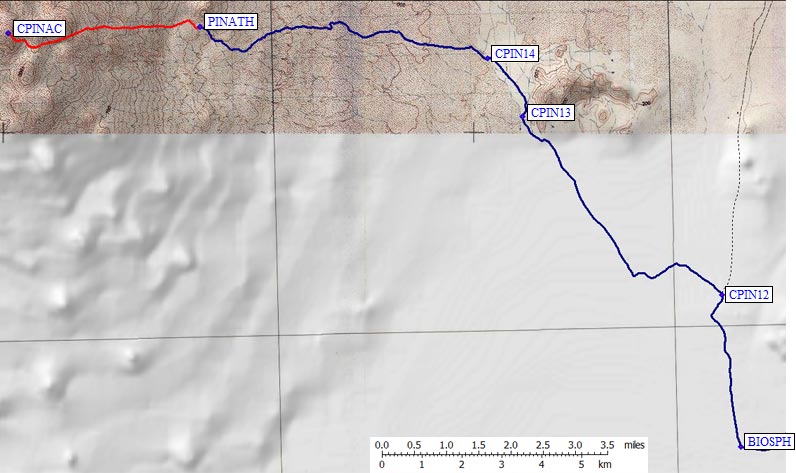
At waypoint CPIN12, 2.5 miles from Hwy 8, turn left onto smaller dirt road at sign for Area Para a Compar Cono Rojo. This smaller road is still a GREAT dirt road, still tempting. For a while. The good road ends at CPIN13, 7.4 miles from Hwy 8, where the roadbed becomes bouncy gravelly lava with some deep sandy spots. There's an abrupt wash at waypoint CPIN14 (8.6 miles from Hwy 8) that will make passenger car drivers think very hard. There are also some high clearance ruts and rocks, but a Kia sedan was parked at the trailhead, proving the road DOES work for passenger cars.
The trailhead is just under 14 miles from Hwy 8 and the Visitor Center, at waypoint PINATH. This is NOT the point I picked off a topo map based on the DPS Guide, but it's close. You can't miss the trailhead sign, picnic table, "No Vehicles" sign, and a very steep rocky climb if you tried to drive beyond here. Park next to the Cono Rojo (Red Cone) for which there are various signs along the way.
DPS reports from the 90s indicate they used to drive on up the road to within a mile of the summit. Whether or not that was legal then, it's definitely not legal now. This is a national park! And I assume most of my readers will be visitors from the U.S. who should show respect for the country they're visiting. Maintenance or science crews DO drive on (we saw several vehicles on that road) but they're not going where climbers want to go.
Route directions according to John:
- forget about all the turns and mileages in the DPS Guide
- walk up the first steep hill from your car
- look at the peak in front of you
- walk toward the peak in front of you
- go left of the peak in front of you
- turn right to the peak you couldn't see behind the peak that was in front of you
- have a nice day
See my 2009 trip report for a more detailed description.
Useful Links: