Adams Peak Trailhead
Revised April 2005 - please send updates to the webmaster
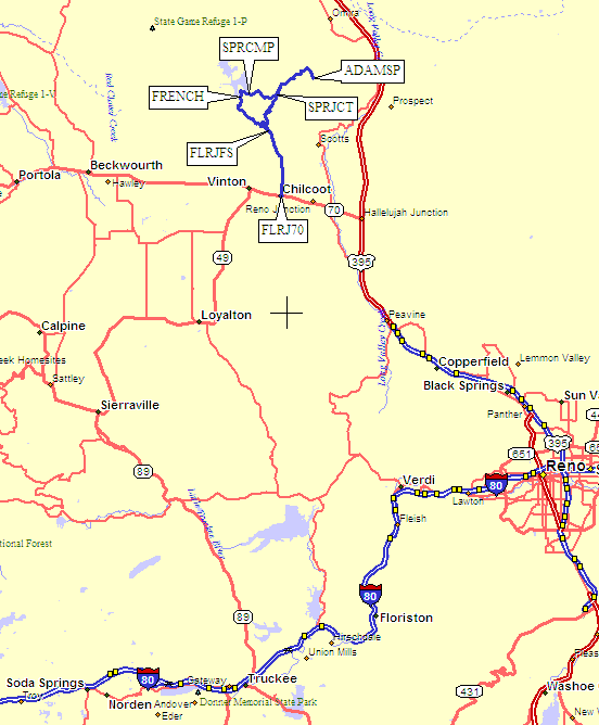
There are two general approaches to the area: If you prefer freeway driving
you should go to Reno on I-80, take Hwy 395 north to Hwy 70, then turn west
toward Chilcoot and the trailhead. If you prefer two-lane driving you should
take Hwy 89 north from Truckee to Sierraville (where I can recommend Los Dos
Hermanos restaurant, open until 8pm all year), then go east and north on
Hwy 49 to Vinton, then turn east on Hwy 70 toward Chilcoot and the trailhead.
Which route is faster depends on traffic and your driving habits!
I-80 and Hwy 395 are faster 4-lane, but slightly longer than Hwy 89 and Hwy 49.
Via Spring Creek Campground, GPS route ADAMS FRENCHMAN LAKE:
Shorter Better Road, GPS route ADAMS SPRING CREEK:
The Final Approach:
Useful Links:Adams Peak Highways:
Adams Peak Trails:
However you get yourself to Hwy 70, turn north on Frenchman Lake Road at
Chilcoot (waypoint FLRJ70), where there is a sign pointing to the Frenchman
Lake Recreation Area. Here is a map of both driving options, which are
described below:
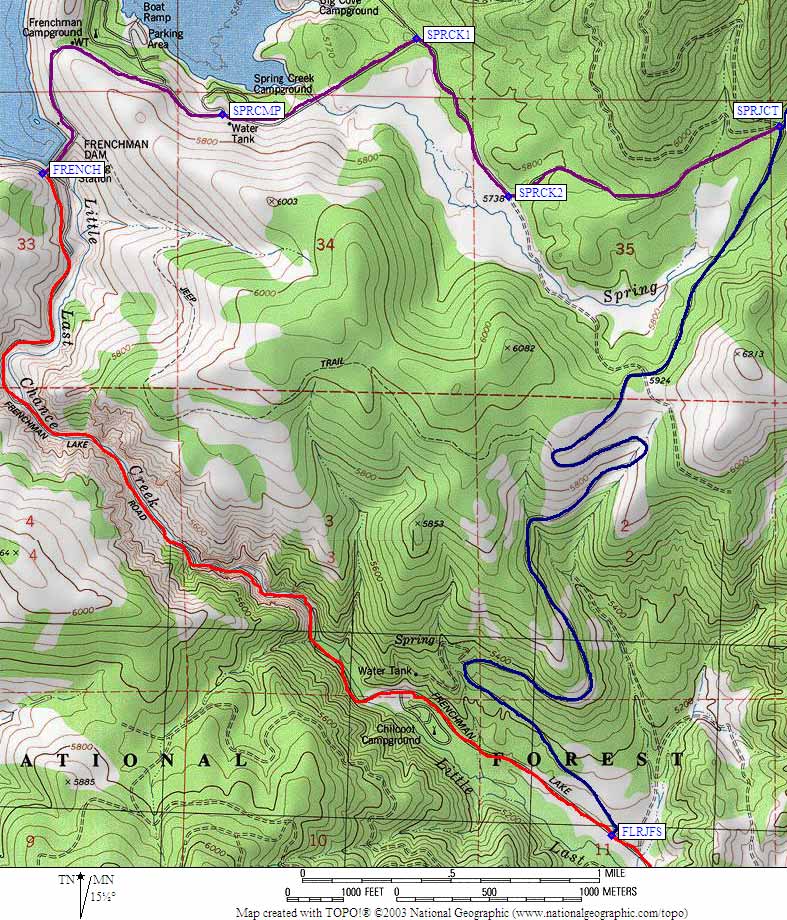
If you want to camp in a campground, follow the red
line up Little Last Chance Creek to Frenchman Lake (past waypoint FLRJFS
to waypoint FRENCH) and turn off the main road to cross the Frenchman Dam
(the purple line). Just past the boat ramp (which motorboats were
using in April) is the Spring Creek Campground (waypoint SPRCMP) which
opens early. In mid-winter you may not be able to drive this far.
By April you should be able to drive much further. From the campground,
go northeast to waypoint SPRCK1 and turn right on a dirt road marked
for Crystal and Adams Peaks. Go southeast to waypoint SPRCK2 and turn
left away from the meadow on the main road. This will take you to a
multi-road intersection at waypoint SPRJCT: signs here point to Adams
and Crystal in different directions, and also to the Chilcoot Campground
by way of waypoint FLRJFS (the better road described in the next paragraph).
If you want to camp in the forest, or if you're just driving to the
trailhead, it is shorter to bypass the campground (and the dirt road
is much better). Leave Frenchman Lake Road (at waypoint FLRJFS) by
turning right (north) on Forest Service Rd 24N44. This good dirt road
may not have a sign, but the turnoff is just before you get to the
Chilcoot Campground, and on the opposite side of the road. Follow this
road (the blue line) north to a multi-road intersection at waypoint SPRJCT:
signs here point to Adams and Crystal in different directions, and also to
the Chilcoot Campground by way of waypoint FLRJFS (the road you just came up).
However you get to waypoint SPRJCT, that's about as far as you want to
take regular passenger cars. If you have high clearance you can drive
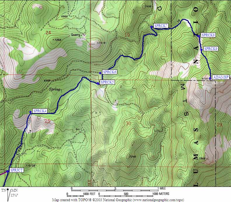
some further or much further, depending on snow. Follow the sign for Adams,
which goes along Spring Creek NNE to waypoint SPRCK4. At or near this corner
we found the road blocked by snow in April, but there were places to park.
There are no gates so how far you can drive is determined by the snow level.
Having done the south shoulder previously, I can assure you the forest is
more open and the slopes are more gentle going to the north ridge of Adams.
Follow the dirt roads along waypoints SPRCK5-SPRCK9, or just follow a
compass bearing if there's lots of snow.